
An Ode to (Topographic) Maps
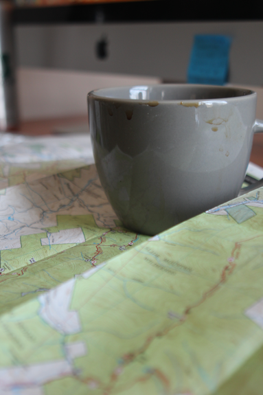
A Catskills map made by the New York - New Jersey Trail Conference goes great with a cup of coffee!
One of my favorite things to do before going out on a hike is to take a good, long look at a map (and to keep it with me when I head outside).
Adventures spill out when I open a trail map: mountains rise and fall with each unfolded quadrant, lakes and rivers appear. Did you know that we can visualize what a three-dimensional mountain will look like with all its shapes and contours just by reading a two-dimensional paper map?
A Catskills trail map shows the region’s high peaks, lower peaks, fire towers, deep notches between mountains, brooks winding in and out, and those elusive trail-less mountains.
At the Catskills Visitor Center, a common visitor question is, do I need to buy a topographic map?
I’ll usually ask some follow-up questions: are you planning to go for a hike? Do you plan to do future hiking in the Catskills? Two yeses are a guaranteed “Yes” from me on whether the person should buy a trail map.
Apart from the satisfying elegance of a paper trail map, the function of the map is real. The Catskill Mountains can often have spotty phone reception, which is a big reason not to rely on cellphone apps for trail information. Cellphones can also have unreliable battery power, especially if it’s a cold day outside.
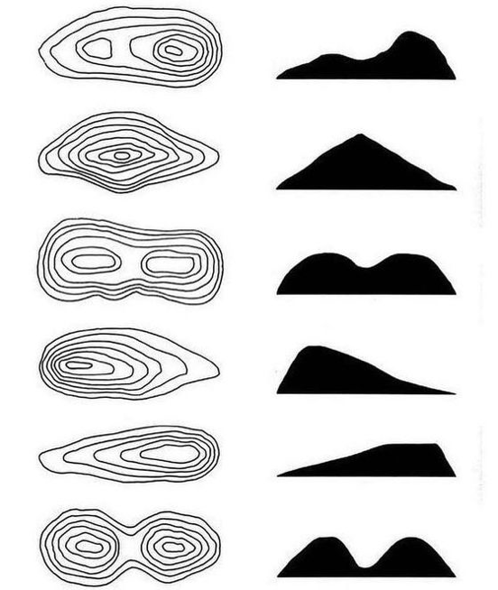
A fun activity with people of all ages is to match the correct mountain shape with its contour lines.
For everyday use, the essentials of trail maps come down to a few main pieces of information:
-mileage and distance
-elevation
-what are the colors of a trail’s disk markers?
-parking lot locations, nearby roads
-surrounding mountains
-public land (wilderness area or wild forest) and private land
Other useful information:
-locations of water sources (especially if you’re backpacking – don’t forget your water filter!)
-where campsites and lean-to shelters are located (backcountry, primitive, and car camping sites)
-do any buses or trains stop nearby?
-how far will you be from the nearest road?
-alternative ways to approach a mountain
For future reading on maps (and compasses), I can’t recommend highly enough a book that I refer to often, called Be Expert with Map & Compass. It’s written by Björn Kjellström, who helped create the modern-day compass with Silva, a Swedish company that he co-founded.
-OB
TOPO CHALLENGE ✨
Make a topographic map of the room (don’t forget the furniture) in which you’re spending most of your time while you’re social distancing and share it with us. #topochallenge
We’ll collect them and share them all!
This excellent sample 🙌🏻 @palatecleanzr
Michael Nelson